An annual report card into South East Queensland’s waterways has reconfirmed the devastating impact caused by this year’s floods on Ipswich waterways.
The Regional Natural Resource Management group Healthy Land and Water has delivered the results of its annual Ecosystem Health Monitoring Program, where the health of the region’s waterways is measured and reported through a regional partnership program, of which Ipswich City Council is a member.
Environment and Sustainability Committee Chairperson Councillor Russell Milligan said it comes as no surprise Ipswich waterways took a significant hit during two flood events earlier this year.
“When rainfall and flooding rips through the region, it exposes areas where our waterways are under increased pressure,” Cr Milligan said.
“The silver lining is that it confirms what we need to do; we need to ramp up proactive investment in the waterways and across the catchments so they can better withstand and bounce back from these extremes.
“Furthermore, proactive investment is five times cheaper than cleaning up after the fact, and also reduces the impact on our community.”
Cr Milligan said council has a series of practical initiatives underway, designed to build resilience to extreme weather events.
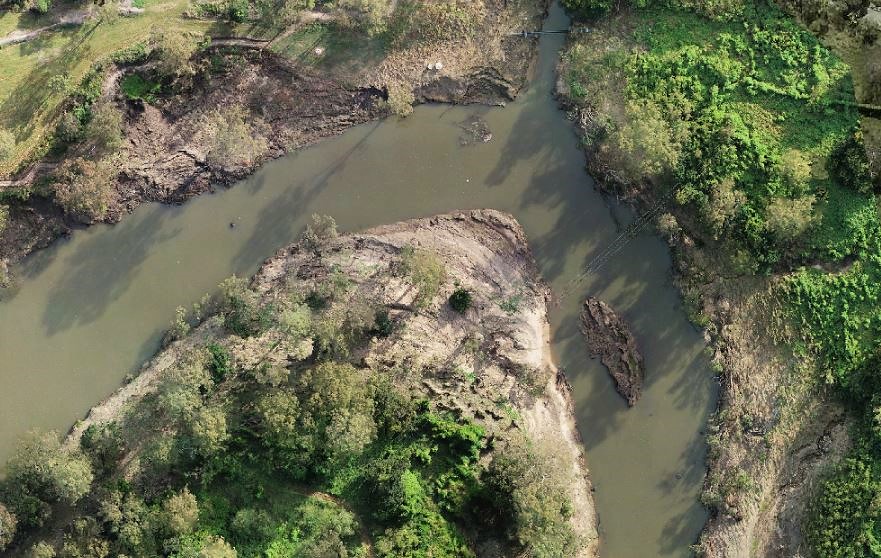
“Recent damage from heavy rainfall and flooding of Ipswich’s major waterways has been mapped with drones,” Cr Milligan said.
“Drone surveys make sure council has the most up-to-date information about creeks and rivers, and they provide a clearer picture of the flood damage, which helps to inform and effectively target our rehabilitation strategy and future decision-making about environmental management.”
Cr Milligan said one of council’s many resilience-building measures is The Franklin Vale Creek Catchment project.
“This catchment in our region’s west suffers from landscape and streambank erosion that impacts water quality and biodiversity downstream,” Cr Milligan said.
“Council has an ongoing partnership with private rural landholders to restore and improve the waterway through actions such as revegetation, establishment of offline watering points and stock exclusion fencing.
“This investment in building a legacy of best-practice land management through engagement and education with landholders has been very positive.”

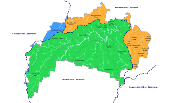
Catchments within the Ipswich region include the below. Management Plans have been developed for these relevant waterways.
- Bremer Catchment Plan
- Deebing Creek
- Ironpot Creek
- Bundamba Creek
- Blacksnake Creek
- Small Creek
- Six Mile, Woogaroo and Goodna Creeks
For more information about the Ipswich Integrated Catchment Plan click here.
Healthy Land and Water CEO Julie McLellan said South East Queensland has more than 20 years of data at decision-makers’ fingertips, thanks to the partners who fund the data monitoring and reporting work for the region each year.
“We are armed with amazing baseline data to help inform good decisions,” Ms McLellan said.
“We know the long-term data shows our region has the potential to bounce back after extremes, but the changing climate is impacting on the region’s capacity to recover between periods of drought and flood.
“With more frequent and intense events on the cards, our landscapes will increasingly not have the time to recover in the same way they used to.”
The Ecosystem Health Monitoring Program is one of the most comprehensive waterway monitoring programs in Australia, delivering an annual regional assessment of the environmental condition and benefits of waterways for South East Queensland catchments.
Read also:
>>> Longer summer opening hours for Riverview Recycling and Refuse Centre


